Archive for May, 2009

Toytrain from Shimla

Sunday, May 31st, 2009
View over Shimla.

View over Shimla.

After the luxury of Sunil looking after us in the jeep for 9 days the public bus to Shimla from Rampur was a bit of a shock – all the chai-wallahs, ice-cream-wallahs and give-me-money-wallahs shouting and getting on and off the bus. One child had a basket with a snake in it (live, but looked both shaken and stirred) – he shoved the thing right under my nose and I could see the tongue flickering in and out. Not sure if I was meant to buy it, eat it, or pay to photograph it but I opted for neither.. Sometimes I do wish I could photograph these weirdos (..don’t care about political correctness when it comes to animal abuse), but I don’t want to give money to encourage this “business”. We had seen a snake charmer with a live cobra in Manali also who wanted us to photograph him – usually the fangs of these snakes are ripped out or the mouth sewn shut – once the thing gets close to dying they toss it away to starve to death and just catch a new one.

The Viceroys toy train.

The Viceroy's toy train.

Our backpacks that had been stored in a box at the back of the bus arrived in Shimla looking like if they had plowed a field with them. We carried the big lumps of dirt on our backs up the hill in Shimla to a hostel where we spent one night before catching a famous narrow-gauge railway down to the town of Kalka the next day. The railroad is a relic from the days of the British, who used the tiny hillstation of Shimla at 2160m to rule the whole sub-continent from for the part of the year when the Indian sun proved to much for the British skin, which was quite a big part. Before they had finally completed the railway in 1903, a handy stretch of 96 kilometers with 103 separate tunnels through the mountain, they used to haul their entire administration up and down a horse-and-cart trail twice a year for 40 years. The train moves at a very relaxing phase, taking 5-7 hours to complete the short trip to the lowlands, and there’s some sort of interesting system in place with drivers and platform staff exchanging brass discs and leather pouches along the way which somehow ensures you can’t meet a train heading the opposite direction. Fail-safe we’re told. The first bit from Shimla is very scenic (you’re probably supposed to take it the other direction so the view gets nicer and nicer..) but along the route, with plenty of stops to buy drinks and food and everyone throwing everything right out the window, it starts to look more and more dirty. I don’t quite follow the reasoning in paying extra for a scenic trip (the bus is much faster and cheaper) and then doing everything you can to make it uglier along the way! But I’ve only been in India for two months of course.. The town Kalka at the other end of the line, complete with shanty-towns on the outskirts, looks entirely indistinguishable from a large rubbish heap.

Not longing to linger in Kalka we already had a train booked onwards to Delhi. This turned out to be the way to travel in style in India – we didn’t even have 1st class but they still served hot food twice on the just over 4 hour trip. In Delhi we walked to a hotel close to the train station recommended by the nice Irish lady we’d shared a taxi to Amritsar with – we weren’t hassled quite as bad by the touts as when we arrived at the airport the first time a month earlier, at 2am culture-shocked and paranoid, but it was still nice to have a place picked out in advance. From Delhi we flew to Port Blair on the Andaman Islands, but that’s for the next post.

Journey to Spiti (part 2)

Tuesday, May 26th, 2009

Day five – Dhankar and Pin

Dhankar monastery.

Dhankar monastery.

Dhankar is taken from a mystical fairytale..some flecks of white paint scattered to the Himalayan winds and landed on the most improbable location high on a quickly eroding hilltop (..moraine; not even a solid rock) where the white-washed buildings that make up Dhankar monastery have clung fast by sheer force of magic for over a thousand years. This place really moved us. The road from Tabo followed the riverbed for some hour until it started climbing the half kilometer vertically up to the Dhankar monastery at 3890m along a serpentine road – the location is just unreal, looking down on the confluence of the Pin and Spiti rivers deep deep in the valley below. We left the jeep, said goodbye to the women who had hitchhiked with us, and Sunil guided us into the gompa. As we climbed up the narrow stairs in the dark inside the monastery we could hear drums beating, and once we reached the top floor where the roof opened up to the sky we could hear the monks chanting. We waited outside in silence for the prayers to finish and I wondered how much of the scene around us might have looked the same a thousand years ago..the monastery with the prayer flags moving in the wind, the view over the barren landscape and snowcapped mountains in the distance, perhaps even the exact words of the monks sacred chant?

Edel at the top of Dhankar monastery.

Edel at the top of Dhankar monastery.

When I asked Sunil how old the buildings were his reply “too much old” had a point – a poster pointed out Dhankar is in imminent danger of collapsing and is listed on a top-100 most endangered world monuments.

A monk eventually popped out and was surprised to see us – we were the first tourists to make it to Dhankar after the long winter. Once the prayer ceremony was finished three more monks showed up – it had sounded like many more back when they were in the prayer room – they gave us tea and showed us around to see all the paintings and ceremonial masks in the many rooms inside the monastery. One of them had very good english, and talking about where we were from Edel mentioned Sweden is very cold and I bragged we had -26 the other winter…he told us it sometimes gets down to -40 in this valley! Three of the monks got a lift with us the short way to Dhankar village, and we left them some of the bags of nuts we had brought for trekking (..can’t be easy to get supplies to a place like this).

Children of Upper Gulling village, Pin river valley.

Children in the Upper Gulling village.

From Dhankar we moved along the Pin river up the valley to Gulling village – Sunil sent us of on a short walk to Upper Gulling a little higher up the mountain and once we got there we were surrounded by little children who wanted their photo taken. Think we had chanced upon their small school actually – more and more children showed up, smiling and pushing each other for the top spots in front of the camera and laughing every time we showed them the photos afterwards. So much fun, and they would almost never let us leave. Wonder if they got any class at all done that day. Once we finally broke free and made our way back to Gulling we had some lunch in a 10 sq.m. restaurant and then made off again to the town of Kaza, once Sunil had found a way to break into the jeep as the keys had gotten locked inside! Luckily it didn’t take too long – the glacial meltwater passing the road on the way was much worse on the way back around lunch and might have made it impassable a few hours later (the whole Pin river had actually changed color from blue to brown since the morning).

Day six – Kibber and Ki

Kibber village.

Kibber village.

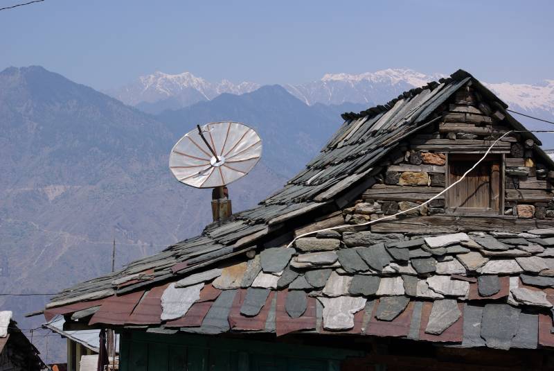
We stayed in Kaza at 3700m and drove the short way to Kibber village at 4200m in the morning. We walked around Kibber forΒ  an hour, it’s a very picturesque little village – apart from just one or two corrugated tin roofs and a few satellite dishes it looks fully traditional. We saw plenty of yaks between the houses, and Edel got stuck with an extremely clingy child that wanted to be carried everywhere. From Kibber we walked downhill to Ki monastery at 3950m. Ki is another hilltop monastery – the location is beautiful, though it’s closer to Kaza town and didn’t quite have the “fantasy” feeling of Dhankar.

Prayer flags on a hill near Kaza.

Prayer flags on a hill near Kaza.

Day seven – return to Nako

Sunset view over Nako.

Sunset view over Nako.

Starting the long way back now – passed Tabo and the terrible landslide area of Malling before spending the night in Nako. Did a nice walk up a hill above town to watch the sunset among the prayer flags in the evening. The guesthouse in Nako was a little dingy, and sported some frightening looking electrical cables by the shower. Food was great though, eaten by a kerosene light as power came and went a bit.

Day eight,nine – return to Kalpa, Rampur

Nice refreshing non-electrocuting showers in our favourite hotel in Kalpa in the evening after another long day on the road. We left Kalpa the next morning just as the sun rose over the Kinner Kailash mountains. It actually set again, to finally rise three quarters of an hour later, as we climbed the serpentine roads down from Kalpa which is about 900 meters above the river valley. The drive down is nice, bonsai-like pines growing out from between the rocks, but once we reached the valley and continued the road towards Rampur the scenery got pretty boring with dam and road construction going on everywhere. The valley used to be very beautiful before the power dams according to the guidebook, but perhaps in the end it’s better they sacrifice one scenic valley than sacrifice the entire natural world by continuing to burn coal…? One amusement along this stretch anyway was the funny roadsigns; some like “What is hurry?” cautioning to drive slower, some like “Sorry for the aah, ooh, auch – inconvenience regretted” apologizing for the state of the road and one “All we need is your smile and cooperation” that presumably has some sort of purpose also…

In Rampur we said goodbye to Sunil, really had a good time with him – playing cards in the evenings and he put us on the phone with his daughters to try their english. And he’d been a fantastically safe driver, something we really appreciated on these roads – most days we barely hit 50kmph. We got a bit of a shock to be back on the public bus to Shimla after the luxury of the jeep for 9 days, but I’ll save that for the next post.

Thanks for the comments everyone – as the roadsign said: All we need is your smile and cooperation to keep us going… πŸ™‚

Journey to Spiti (part 1)

Tuesday, May 26th, 2009

Day one – to Sarahan

We’re doing this in the wrong direction and at the wrong time..as usual. The route to Spiti valley from Manali is normally done as a circular circuit, but two of the high mountain passes the road climbs through, Rohtang and Kunzum, haven’t cleared after the winter yet. And considering the name of the less challenging of the two, Rohtang, translates as “piles of dead bodies” it doesn’t seem to be the kind of situation where you should push your luck. So we’ll be driving in towards Spiti the long way instead, and then exiting using the same route. It’s nice to do the trip out-of-season though, less traffic on the roads (which we appreciated once we saw the state of them..) and we had the privilege to be some of the first tourists to reach many of the places this year.
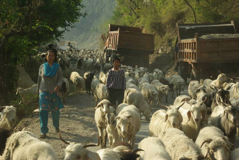
On the road towards Jalori Pass.

On the road towards Jalori Pass.

In the morning of day one we met our driver Sunil, and settled into the jeep. The road climbed a full kilometer downhill from Manali’s 2000m, before climbing up again to Jalori Pass at 3200m. Apart from all the climbing the drive was pretty relaxing with the jeep occasionally getting stuck in a flock of goats or sheep or behind a mule train. Jalori pass is still well below the snow-line and we did a nice walk in the mixed forest close to the top. Sunil didn’t give us that much instructions before sending us off, but some nice Indian tourists with very little english that we met told us it was a circular walk, which it wasn’t, so we continued on expecting to eventually come back to where the jeep was parked again.. This might be a good moment to thank my dear colleagues back home again for the GPS unit, or we might still be hiking the woods of Jalori Pass! πŸ™‚

Roof near the Bhimakali temple in Sarahan.

Roof in Sarahan, near the Bhimakali temple.

We spent the night in the village of Sarahan, in a pretty basic hostel (hot water came in buckets left outside the room). In the morning we explored the Bhimakali temple, an elaborate wooden structure which is Sarahan’s no.1 attraction. It’s built mostly in the early 1900’s, but some stone sections are much older and used to be used for human sacrifice until the British came along and stopped all the fun in the 1800’s. One man per decade used to be sent off to the Bhima Kali Hindu deity here, though the goddess now has to make do with a water-buffalo calf, a sheep, a goat, a fish, a chicken, a crab and a spider instead in a complex ceremony held each October…

Day two – to Chitkul
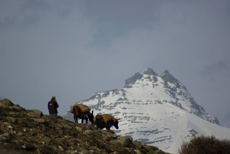
Mule train near Chitkul.

Mule train near Chitkul.

Some of the roads on the way to Sarahan, and from Sarahan to Chitkul, took a bit of getting used to (see pics in the last post). Huge drops by the side, sometimes with a bit of broken railing but more often just with some small white-painted rocks along the side instead. We traveled plenty “relaxed safety” serpentine road back in South America on the last trip so this wasn’t all news, but I still think I maintained a healthy level of terrorizing fear for most of the first day or so.. The brain does funny things..like wanting you to close the car window and lock the door just so the “unpleasant-ness out there can’t get in”.. You get de-sensitized very quickly though – after a couple hours with half a kilometer drop outside the window you don’t react at all when the drop is “just” 50 meters no matter how close to it or how fast the car goes..even though the fall might hurt roughly the same. Sunil seemed a very safe driver though, and after a couple days there was just one spot that might still frighten me; Malling..I’ll get back to Malling later on.. I think the roads we had on the 9 days here were probably worse than the ones we saw in South America last time, though the driving here is better. South America has more of the macho driving style where everyone needs to overtake every other vehicle always and including on blind corners, and of course no-body will allow anyone else to overtake them without a fight as it would be a direct insult to the drivers manliness (..I remember even public buses racing eachother back there!). Indian driving seems slightly more relaxed, at least up in the mountains.
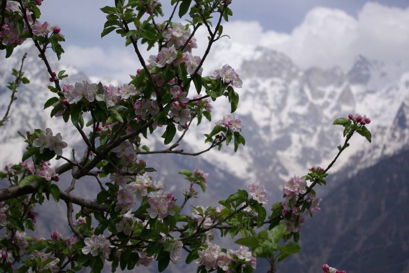
Apple orchard in Kalpa.

Apple orchard in Kalpa.

Chitkul was a cute little village at 3500m, just where the road up the Baspa river valley ends and the mule tracks take over. Up here the landscape was a bit more barren, and it was pretty cold – partly as the hotel we were staying in was still missing a few walls. It’s the usual method up here – build one or two floors and finish a couple rooms so that you can start to take in guests and make some money to finish the rest of the building! Half the places we stayed had concrete arming bars sticking up from an unfinished roof and lots of “natural light”. As we were among the first people to stay in the hotel in Chitkul the place was very clean anyway πŸ™‚

Along the road down again from Chitkul the next day a Hindu holy man was handing out good luck charms and blessing drivers for the journey down for the small fee of 20 rupees, an absolute bargain I think considering the state of the road!

Day three – to Kalpa
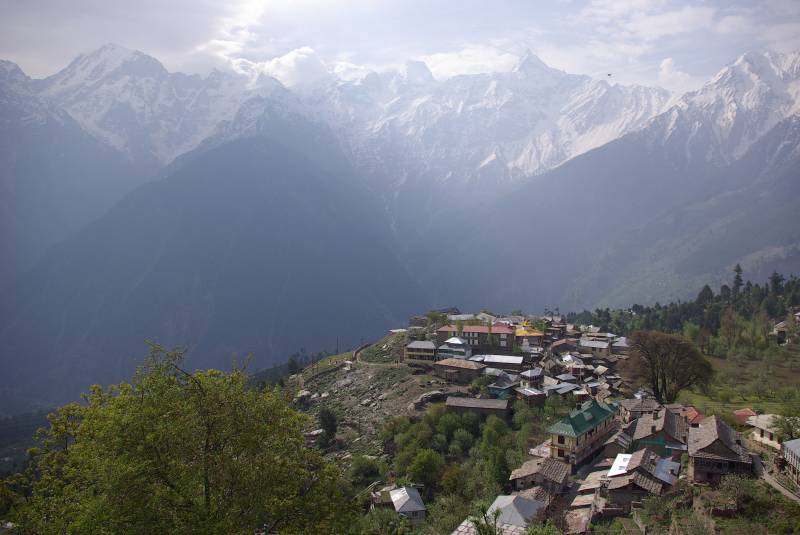
View over Kalpa.

View over Kalpa.

Before continuing to Kapla we stopped in the town Rekong Peo to sort out our Inner Line Permit – some of the areas we planned to visit are very close to the sensitive Tibet border and therefore need a special permit. The area was actually completely off limit to foreigners until 1992. While waiting for the permit for some hours we walked the town a bit and had a lime soda in a roadside restaurant where the menu said “Thanks for patronizing us” as well as promising to “serve you more and more better” if you visit again. Always eager to please Edel went back in with the drinks and asked them to please prepare them again without the extra hay and dirt. The drinks came back out with a lot less fizz so we stocked up on more amoeba medicine in the pharmacy across the street just in case they had used tap water.. We did have breakfast in an even dirtier place on the first day actually..it looked more like a building-site than a restaurant. I was picking hair from my toast+butter and they left a large big lump of dirt on the table that on closer inspection was revealed to contain a plastic bottle of tomato sauce. They also walked right past us down to the river with a couple buckets of plastic garbage and dumped them right in the river as we watched on.. Edel has a theory that any restaurant here with women working in it is a lot cleaner, and it seems to be true so far. There’s always an exception though – in the lovely place we stayed in Kalpa the old gentleman working the kitchen cooked up some fantastic food for us. Kalpa was a really nice spot, apple orchards in bloom and fantastic views towards the Kinner Kailash mountains across the river valley. Kalpa is at 2800m, a full 900 meter climb up serpentine roads from the main road tracing the river valley below.
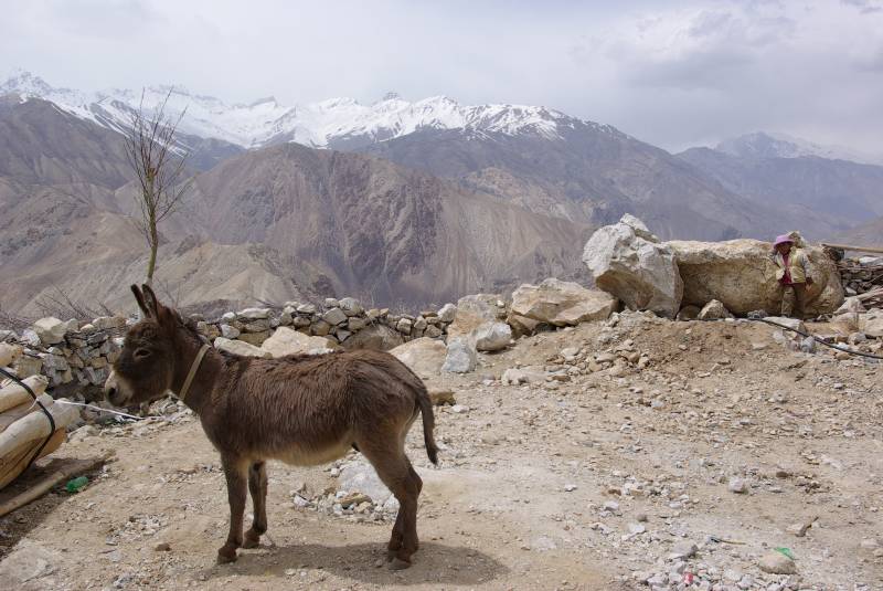
Donkey near Nako village.

Donkey near Nako village.

Day four – to Tabo

The landscape changed dramatically on the road north leaving the Kinnaur area and movin towards Tabo – the greenery and the trees gone completely as we neared the Spiti valley’s high-altitude desert. The highest points we passed were the tiny villages of Nako at 3600m, where we had a 20 rupee lunch in a roadside stall close to this donkey, and Malling at 3800m. Malling is probably the worst piece of road we have ever seen anywhere. It is in a notorious landslide area, when the guidebook was written they had already tried to make a permanent road there for some decade but at the time you could only scramble across and catch a different vehicle on the other side. Currently the higher of the roads was actually open while a lower road had recently been swallowed up by the mountain again. Sunil, though he had driven the area for 30 years, had to ask for directions along the way to find out which roads were passable as we were the first tour of the year. For a few hundred meters when passing Malling the broken asphalt gives way to loose scree and the road feels very freshly made..the drop on the side is pretty intimidating even after some days getting used to the area. I couldn’t take any photos on the way in as we were giving lift to a military officer at the time (photography inside the Inner Line isn’t officially allowed) but on the way back some days later (..as we had to exit the same route) I caught a couple movies with Edel’s camera.
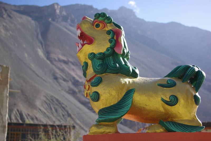
Figure by the Buddhist stupa in Tabo village.

Figure by the Buddhist stupa in Tabo village.

Once reaching Tabo at 3300m we checked in to the Gompa of the local monastery guest house – very basic and no hot water, but the restaurant served some fantastic Tibetan food; momos (dumplings) and thukpa soup. In the morning we explored the ancient Tabo monastery – parts of it are from AD996 and apparently houses some of the best Buddhist art in the Himalayas, though many of the buildings were still locked as the season hadn’t opened yet. It was still nice to explore the outside; ancient ruins and stupas, prayer stones and carvings.

Road safety report

Sunday, May 24th, 2009

I will post a longer post in a little while about our 9-day jeep safari to the Spiti valley..for now here is an illustrated “road safety report” πŸ™‚

Day one.

Day one.

Day two.

Day two.

Day three.

Day three.

Day four.

Day four.

Day five.

Day five.

Day six.

Day six.


(more movie clips)

Day seven.

Day eight.

Day eight.